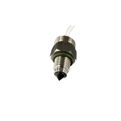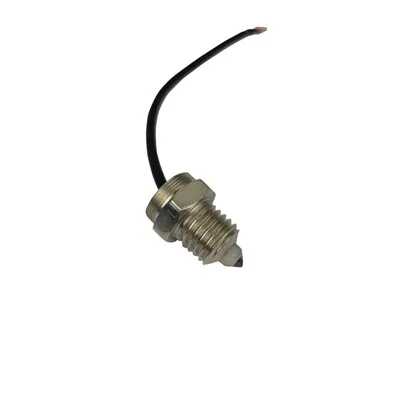
The Power of LiDAR water level sensors
Non-Contact Water Level Monitoring for Smarter Decisions
When water levels change, every minute matters. Whether you manage stormwater infrastructure, reservoirs, wastewater systems, irrigation canals, industrial tanks, or flood-prone sites, accurate level data helps you respond faster, reduce risk, and protect assets. Modern lidar water level sensors give teams a reliable way to measure water levels without placing equipment in the water.
Built around advanced lidar technology, this non-contact sensing solution is designed for organizations that need dependable measurements in the field, easy integration with monitoring systems, and less time spent on manual inspections. It supports remote sensing strategies for sites that are difficult, unsafe, or expensive to visit regularly.
Measure Water Levels Without Contact
Traditional level monitoring methods often require submerged probes, floats, pressure sensors, or staff gauges. These can be effective, but they may also be exposed to fouling, corrosion, debris, biofilm, sediment, and maintenance challenges.
LiDAR-based measurement works differently. The sensor emits a light pulse toward the water surface and measures the return signal to calculate distance. Because the sensor sits above the water, it can capture level changes without direct contact.
That means fewer moving parts, less exposure to harsh water conditions, and a cleaner installation for many applications.
Designed for Real-World Water Applications
Water environments are rarely controlled. Levels rise quickly during storms. Channels collect debris. Industrial sites may involve changing conditions. Remote locations may have limited power or communication access.
Our LiDAR water level sensing solution is built for practical deployment across a wide range of U.S. water monitoring use cases, including:
Stormwater detention and retention basins
Rivers, creeks, and flood monitoring points
Wastewater lift stations and wet wells
Reservoirs, lakes, and ponds
Irrigation canals and open channels
Industrial process water tanks
Agricultural water management systems
Transportation drainage infrastructure
Municipal water and environmental monitoring programs
From urban infrastructure to rural field sites, LiDAR provides a flexible way to collect water level data while keeping the sensing element out of the water.
Key Benefits
Accurate Non-Contact Measurement
LiDAR sensors can detect level changes from above the surface, helping reduce issues caused by submersion, sediment buildup, or floating debris. This makes them a strong fit for monitoring points where water quality or site access makes contact sensors difficult to maintain.
Lower Maintenance Requirements
Because the sensor is not submerged, routine cleaning and replacement needs may be reduced compared with some contact-based technologies. For teams managing many sites, this can help lower truck rolls and improve operational efficiency.
Faster Response With Remote Sensing
Remote sensing enables teams to monitor water levels without relying only on site visits. When paired with telemetry, data logging, or a cloud dashboard, LiDAR-based systems can help operators identify rising levels, detect unusual patterns, and make more informed decisions.
Flexible Installation Options
Install above open water, tanks, channels, vaults, or basins using a suitable mounting structure. The sensor can be positioned to measure distance to the water surface while remaining accessible for inspection and service.
Built for Data-Driven Operations
Water level data becomes more valuable when it connects to the systems your team already uses. Depending on configuration, LiDAR technology can support integration with data loggers, telemetry devices, SCADA systems, alarms, dashboards, and reporting workflows.
Product Features
Non-contact water level measurement using LiDAR sensing
Designed for outdoor and industrial monitoring environments
Supports remote sensing and automated data collection workflows
Suitable for open channels, basins, tanks, reservoirs, and wet wells
Compact form factor for flexible mounting
Options for integration with telemetry, controllers, and monitoring platforms
Configurable measurement intervals based on site requirements
Helps reduce exposure to waterborne contaminants, debris, and corrosion
Supports proactive maintenance, alerts, and trend analysis when connected to a monitoring system
Useful for both permanent installations and temporary monitoring projects
How LiDAR Technology Works for Water Level Monitoring
LiDAR stands for Light Detection and Ranging. In a water level monitoring application, the sensor sends a light signal toward the surface below. The signal reflects back to the sensor, and the system calculates the distance based on the time it takes to return.
That distance can then be converted into a water level reading using the installation height or a reference point. For example, if the sensor is mounted above a channel, the system can track how far the water surface is from the sensor and translate that into level changes over time.
Because the measurement is optical and non-contact, LiDAR can be especially useful where submerged equipment may be exposed to buildup, shifting sediment, or hard-to-access conditions.
Built for Municipal, Industrial, and Environmental Teams
LiDAR water level sensors are a smart choice for teams that need reliable data across distributed assets. Municipal public works departments can monitor stormwater sites. Utilities can track wet wells and wastewater infrastructure. Environmental teams can collect level data from rivers, wetlands, and restoration sites. Industrial facilities can improve visibility into tanks, containment areas, and process water systems.
For many organizations, the value is simple: better visibility, fewer manual checks, and faster decisions when conditions change.
Common Use Cases
Flood and Stormwater Monitoring
Track rising water levels in basins, culverts, channels, and flood-prone areas. Remote level data can help teams prioritize site inspections and respond before conditions become critical.
Wastewater and Lift Station Monitoring
Monitor wet well levels from above the water surface. Non-contact sensing can help reduce direct exposure to wastewater and limit issues caused by submerged sensor fouling.
Reservoir and Surface Water Management
Collect level trends from ponds, lakes, reservoirs, and canals. LiDAR-based measurement supports long-term observation and data-driven water resource planning.
Industrial Water Systems
Use LiDAR technology to monitor water storage, containment, or process-related applications where a non-contact approach is preferred.
Temporary Field Projects
Deploy sensors for construction, environmental studies, drainage assessments, or emergency response monitoring where fast setup and remote visibility are valuable.
Specifications and Configuration Options
Every site is different, so the best configuration depends on your mounting height, measurement range, power availability, communication needs, and data requirements. Available options may include:
Measurement range selected for the application
Outdoor-ready housing options
Data logging and telemetry compatibility
Battery, solar, or wired power configurations where supported
Mounting hardware for poles, brackets, structures, or enclosures
Integration support for monitoring dashboards or existing control systems
Alerting and reporting options when paired with compatible software
For exact specifications, configuration details, and compatibility recommendations, request a consultation with our product team.
Pricing
Pricing depends on the sensor configuration, quantity, mounting requirements, power setup, communication method, and any monitoring platform or integration support needed for your project.
To keep your quote accurate, we recommend sharing a few basic details:
Type of site or application
Approximate mounting height above the water surface
Number of monitoring locations
Preferred power source
Communication needs, such as cellular, radio, wired, or local logging
Any existing systems you want to connect with
Request a custom quote to get the right LiDAR water level sensor setup for your project.
Why Choose a LiDAR-Based Water Level Sensor
A reliable water monitoring program depends on consistent data, practical maintenance, and equipment that fits the environment. LiDAR offers a strong balance of performance and convenience for many water level applications.
Choose LiDAR when you want:
A non-contact alternative to submerged sensors
Better access to remote or distributed sites
Reduced maintenance from fouling or debris exposure
Fast insight into changing water conditions
Flexible integration with digital monitoring workflows
A scalable approach for single-site or multi-site deployments
Get the Right Sensor for Your Site
Not sure which configuration is best? Our team can help review your application, identify key site considerations, and recommend a LiDAR water level monitoring setup that fits your goals.
Whether you are upgrading aging infrastructure, building a remote sensing network, or adding visibility to a hard-to-reach locati0n, LiDAR technology can help you monitor water levels with confidence.
Request a Quote or Product Consultation
Ready to improve water level monitoring with non-contact sensing? Contact us today to discuss your application, compare configuration options, and receive a custom quote for LiDAR water level sensors built around your site requirements.