How to Measure Water Levels in Wells Rivers and Lakes
Accurate water level measurement helps property owners, environmental teams, utilities, farmers, engineers, and facility managers understand how water behaves over time. Whether you are checking a groundwater well, monitoring a river stage, or tracking lake levels, the goal is the same: collect reliable level data that supports better decisions.
Water levels can change because of rainfall, drought, pumping, snowmelt, tides, evaporation, irrigation, dam releases, and seasonal recharge. A single reading can be useful, but consistent measurements are far more valuable. With the right method, equipment, and maintenance routine, you can detect trends early, protect infrastructure, manage water resources, and reduce risk.
What Water Level Measurement Means
Water level measurement is the process of determining the height or depth of water relative to a known reference point. That reference point might be the top of a well casing, a staff gauge zero mark, a bridge benchmark, a lake shoreline marker, or a fixed sensor installation.
The measurement may be expressed as:
Depth to water, commonly used in wells, such as feet or meters below the measuring point
Water surface elevation, often used in hydrology and engineering
Stage height, commonly used for rivers, streams, and lakes
Tank or reservoir level, used in storage and process applications
The best method depends on the site, accuracy requirements, budget, access conditions, and whether you need occasional manual readings or continuous monitoring.
Measuring Water Levels in Wells
Wells require methods that can measure the distance from a fixed point at the surface down to the water table or pumping level. Because the water surface may be many feet below ground, well measurement often relies on specialized tools.
Electric Water Level Meters
An electric water level meter is one of the most common tools for measuring wells. It usually includes a graduated tape, probe, reel, and indicator. When the probe touches the water, the circuit closes and triggers a light or buzzer.
This method is useful because it is:
Simple to operate
Portable
Suitable for many groundwater monitoring wells
Accurate when the tape is marked clearly and used consistently
To use it properly, lower the probe slowly into the well until the signal activates. Record the depth from the marked measuring point, not from an inconsistent surface such as the ground. After use, clean and decontaminate the probe and tape, especially when moving between wells.
Steel Tape and Chalk Method
A steel tape coated with water-indicating chalk can also be used for manual well measurements. The tape is lowered past the expected water level, then pulled back up. The wetted mark shows where the tape contacted the water.
This method can be accurate, but it requires care. It may be less convenient than an electric meter, particularly in deep wells or locations where repeated measurements are needed.
Pressure Transducers for Wells
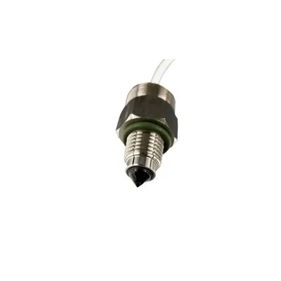
For continuous monitoring, many sites use submerged water level sensors, such as pressure transducers. These devices measure the pressure created by the water column above the sensor and convert that pressure into level.
Pressure sensors are useful when you need to track changes over hours, days, seasons, or years. They can be connected to data loggers, telemetry systems, or remote dashboards. In wells, they are often installed below the lowest expected water level and programmed to record at set intervals.
When using pressure-based sensors, remember that barometric pressure can affect readings. Some systems include vented cables, while others require separate barometric compensation.
Measuring Water Levels in Rivers
Rivers are dynamic. Flow conditions can change quickly during storms, snowmelt, dam releases, or flooding. Because rivers are often used for flood forecasting, water supply, navigation, recreation, and environmental monitoring, consistent measurement is essential.
Staff Gauges
A staff gauge is a fixed, graduated ruler installed where water levels can be read visually. It is one of the simplest and most durable forms of river level measurement.
Staff gauges are best for:
Manual observations
Calibration checks for automated systems
Low-cost monitoring stations
Sites where trained personnel can visit regularly
The gauge must be installed securely and referenced to a known datum. If the gauge shifts, bends, or becomes buried by sediment, readings may become unreliable.
Stilling Wells
A stilling well is a vertical pipe or chamber connected to the river. Water enters through openings, allowing the level inside the well to rise and fall with the river while reducing wave action and turbulence.
Inside the stilling well, technicians can install floats, encoders, pressure sensors, or other instruments. This approach is useful where direct sensor exposure to debris, ice, or fast-moving water could cause damage.
Radar and Ultrasonic Sensors
Non-contact water level sensors are widely used for rivers because they can measure from above the water surface. Radar sensors send signals toward the water and calculate level based on the return time. Ultrasonic sensors use sound waves in a similar way.
These systems can be mounted on bridges, platforms, or dedicated structures. They reduce the need to place equipment in the water, which can improve safety and lower maintenance in debris-prone locations.
Radar is often preferred in challenging outdoor environments because it is less affected by temperature gradients, wind, mist, or condensation than some ultrasonic devices. However, each site should be evaluated before selecting a sensor.
Measuring Water Levels in Lakes
Lakes usually change more slowly than rivers, but they still require accurate monitoring. Levels may rise or fall because of precipitation, inflow, outflow, evaporation, groundwater exchange, dam operations, or water withdrawals.
Manual Lake Gauges
A staff gauge placed near a dock, shoreline structure, or control point can provide simple lake level readings. For long-term accuracy, the gauge should be installed where it remains visible during expected high and low water conditions.
Manual readings work well for community monitoring, property management, and basic environmental tracking. However, readings should be taken at consistent times and recorded carefully.
Pressure-Based Lake Sensors
Submerged pressure sensors can measure lake levels continuously. They are often installed in protective housings to reduce damage from waves, boats, floating debris, ice, or sediment.
These sensors are helpful when lake levels need to be monitored for dam control, flood planning, ecological studies, irrigation storage, or shoreline management. Regular inspection is important because sediment buildup or biological growth can affect performance.
Non-Contact Lake Monitoring
Radar or ultrasonic sensors can also be used over lakes, especially from piers, bridges, outlet structures, or monitoring platforms. Because lakes can experience wind-driven waves, sensor placement and signal averaging are important for stable readings.
Liquid Level Gauges vs. Sensors
The terms liquid level gauges and sensors are sometimes used interchangeably, but they are not always the same.
A liquid level gauge usually provides a visible or mechanical indication of level. Examples include staff gauges, sight gauges, float gauges, and marked tapes. Gauges are often simple, durable, and easy to inspect.
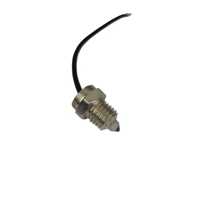
Water level sensors typically convert level into an electrical signal. They can support automated data logging, alarms, remote access, and integration with control systems. Examples include pressure transducers, radar sensors, ultrasonic sensors, float switches, and capacitance probes.
In many monitoring programs, both are used together. A manual gauge provides a quick visual reference, while an automated sensor provides continuous data.
Choosing the Right Method
Before selecting equipment, consider the measurement environment and the purpose of the data.
Key questions include:
Is the site a well, river, lake, tank, reservoir, or canal?
Do you need manual readings or continuous monitoring?
How accurate does the measurement need to be?
Will the equipment face ice, waves, flooding, debris, sediment, or vandalism?
Is the water clean, turbid, corrosive, or biologically active?
Is power available at the site?
Do you need remote data transmission?
How often can the site be maintained?
For occasional well checks, an electric water level meter may be enough. For flood-prone rivers, a non-contact radar sensor with telemetry may be more suitable. For lakes, a combination of staff gauge and pressure sensor can provide both visual confirmation and continuous records.
Best Practices for Reliable Readings
Accurate water level measurement depends on more than the device itself. Technique, installation, calibration, and documentation all matter.
Follow these best practices:
Use a fixed reference point Always measure from the same marked point. In wells, this is often the top of casing. For surface water, use a surveyed gauge datum or benchmark.
Record conditions during measurement Note weather, recent rainfall, pumping activity, river conditions, ice, debris, or anything else that may affect the reading.
Calibrate and verify equipment Compare sensor readings with manual measurements at regular intervals. A staff gauge or electric meter can help confirm automated data.
Protect equipment from damage Use stilling wells, protective housings, conduit, locks, or elevated mounts where needed.
Account for environmental factors Pressure sensors may need barometric correction. Ultrasonic sensors may be affected by air temperature and surface turbulence. Submerged sensors may be affected by sediment or biofouling.
Maintain clean instruments Clean probes, tapes, sensor faces, vents, and housings. In groundwater work, decontaminate equipment between wells to reduce cross-contamination risk.
Keep detailed records Record the date, time, locati0n, measuring point, instrument used, reading, and observer. Consistent records make data more useful over time.
Common Mistakes to Avoid
Even simple measurements can be misleading if taken incorrectly. Avoid these common errors:
Measuring from different reference points each time
Forgetting to subtract casing height or sensor offset
Ignoring barometric compensation for pressure sensors
Installing sensors where turbulence, sediment, or debris is severe
Allowing staff gauges to shift without resurveying
Failing to compare automated readings with manual checks
Recording data without units or context
A few inches or centimeters of error may not matter for casual observation, but it can be significant for flood alerts, groundwater studies, pump management, or regulatory reporting.
Turning Measurements Into Useful Data
The real value of water level measurement comes from trends. A series of readings can show whether groundwater is declining, a lake is recovering after drought, or a river is rising faster than expected.
Useful outputs may include:
Daily, weekly, monthly, or seasonal level trends
Hydrographs showing water level over time
Alerts for high or low thresholds
Comparisons between rainfall and level response
Pumping impact analysis in wells
Flood stage tracking for rivers
Storage estimates for lakes and reservoirs
When data is collected consistently, it becomes easier to plan maintenance, manage withdrawals, protect property, and make informed water resource decisions.
Final Thoughts
The best approach depends on the water body, site conditions, and monitoring goals. Manual tools such as staff gauges, electric meters, and chalked tapes are practical for spot checks and verification. Automated water level sensors provide continuous data, alarms, and long-term records. Liquid level gauges offer dependable visual reference points that can support both manual and automated systems.
For wells, focus on repeatable depth-to-water measurements from a fixed point. For rivers, prioritize durable installations that can handle changing flow, debris, and flood conditions. For lakes, choose equipment that can manage waves, seasonal variation, and long-term exposure.
With the right method and a consistent process, water level measurement becomes more than a number. It becomes a dependable tool for understanding, managing, and protecting water resources.